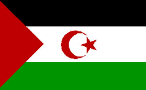
Western Sahara
Digital Passport

Total area: 102,703 sq mi (266,001 sq km)
Population (2013 est.): 554,795 (growth rate: 2.89); birth rate: 30.71; infant mortality rate: 56.09; life expectancy: 62.27; density per sq mi: 5
Largest city (2010 est.): El Aaiun 196,331
Monetary unit: Tala
Languages: Standard Arabic (national), Hassaniya Arabic, Moroccan Arabic
Ethnicity/race: Arab, Berber
Religion: Islam
Economic summary: GDP/PPP: $906.5 million (2007 est.) Inflation: n.a. Arable land: 0.02%. Agriculture: fruits and vegetables (grown in the few oases); camels, sheep, goats (kept by nomads); fish. Labor force: 144,000 (2010 est.); animal husbandry and subsistence farming 50%. Industries: phosphate mining, handicrafts. Natural resources: phosphates, iron ore. Exports: n.a.: phosphates 62%. Imports: n.a.: fuel for the fishing fleet, foodstuffs. Major trading partners: Morocco claims and administers Western Sahara, so trade partners are included in overall Moroccan accounts.
Communications: Telephones: main lines in use: about 2,000 (1999 est.); mobile cellular: 0 (1999). Radio broadcast stations: Morocco’s state-owned broadcaster, Radio-Television Marocaine (RTM), operates a radio service from Laayoune and relays TV service; a Polisario-backed radio station also broadcasts (2008). Radios: 56,000 (1997). Television broadcast stations: n.a. Televisions: 6,000 (1997). Internet Service Providers (ISPs): 1 (2000).
Transportation: Railways: 0 km. Highways: total: 6,200 km; paved: 1,350 km; unpaved: 4,850 km (1991 est.). Ports and harbors: Ad Dakhla, Cabo Bojador, Laayoune (El Aaiun). Airports: 6 (2013).
Fun Facts
- The natural hazards are hot, dry, dust-laden sirocco wind
- Agriculture includes fruits and vegetables that are grown in the oase
- Home to the toughest foot race ever
Videos
